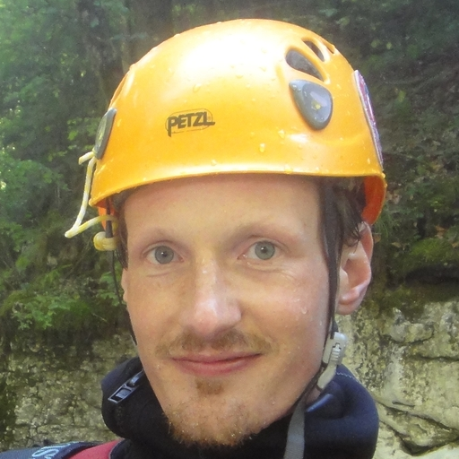
Max H.
About You:
Weltreisender, Musiker, Vater, Kletterer ... und Canyonaut aus Salzburg Umgebung
Tasks/Role description:
Aktuell technischer Lead von OpenCanyon.org
Activity:
Reports: 49
Uploads: 293
Edits: 57
New Canyons: 8
Commits: 2603
Uploads: 293
Edits: 57
New Canyons: 8
Commits: 2603
Reports:
07.07.2026
Rio Frondizzon
Erik Weisz
⭐
★★★★★
📖
★★★
⚓
★★★
💧
Low
Completed ✔
Other users were: Max H. László Szabó

Quick run through Frondizzon. We walked up from the parking lot in about 45-50 mins at a slightly slow pace, and got through the canyon in about 1,5 hours, starting directly before the 35m rappel. The canyon was more chill than exciting at this water level (picture is right before the 35m), but still a really nice canyon with the cave-like elements.
Other users were: Max H. László Szabó
06.07.2026
Torrente Leale
Erik Weisz
⭐
★★★★★
📖
★★★
⚓
★★★
💧
Normal
Completed ✔
Other users were: Max H. László Szabó


Very nice aquatic canyon. On the walk up, no water on the road crossing, then at the dam, only the lowest single hole had water coming out. However, the canyon itself had normal water level, looked a bit scary but it wasn’t difficult/dangerous.
New glued anchor after SOS4, where there is a slightly tricky downclimb/jump (we didn’t use it, but thanks!)
Other users were: Max H. László Szabó
05.07.2026
Rio Tralba (Inferiore)
Erik Weisz
⭐
★★★★★
📖
★★★
⚓
★★★
💧
Normal
Completed ✔
Other users were: Max H. László Szabó

Great canyon, great day, just right water level for our ability. The walk in from the upper parking lot is very nice, in the shade almost all the way, and mostly level, not much elevation. The last wooden bridge is now a bit collapsed, but still usable.
Wish the canyon had less climbing over rocks and hiking, that would make it a 5/5 canyon for me.
Other users were: Max H. László Szabó
04.07.2026
Rio Lavarie
Erik Weisz
⭐
★★★★★
📖
★★★
⚓
★★★
💧
Low
Completed ✔
Other users were: Max H. László Szabó

Everything was fine in the canyon. We ascended from the bottom parking lot on foot. On the way up, we lost the path a bit at some service towers. There, we stayed to the left a bit, then ascended a mini via ferrata, after that the path was clear again (all on OSM).
Other users were: Max H. László Szabó
16.06.2026
Pombeiro
Max H.
⭐
★★★★★
📖
★★★
⚓
★★★
💧
Normal
Completed ✔
machine translated
➜
Original language
Other users were: David Mason
Wir haben Nähe Adventurepark geparkt, ggf. wäre es besser gewesen weiter vorne zu parken und zu Fuß der Straße entlang zum Adventurepark zu gehen. Weiters kann man angeblich seine nassen Sachen vom Restaurantsbesitzer im Adventurepark beim Canyonausstieg abholen lassen. Zustieg bitte an den GPS Track halten, nach der Erreichung des Adventurparkes sollte man in 5min im Bach sein. Dann 5min Blockhüpfen bevor Schlag auf Schlag viele Abseilstellen kommen. Abseiler sind top eingerichtet und Abseilen im Wasser gefällt gut, höchste Abseilstelle 25m, Tourdauer etwa 2h. Am Ende kommen wir bei einer Brücke an, von dort aus hochlaufen bis zum Adventurepark knapp 1h. Hätten wir vorher gepart ggf. nur 40min.
We parked near the Adventure Park; it might have been better to park further ahead and walk along the road to the Adventure Park. Also, you can apparently have the restaurant owner at the Adventure Park pick up your wet gear for you at the canyon exit. Please follow the GPS track for access; once you reach the Adventure Park, you should be at the stream within 5 minutes. Then it’s 5 minutes of hopping over boulders before you hit a series of rappelling spots one after another. The rappel stations are very well set up, and rappelling in the water is a lot of fun; the highest rappel point is 25 meters, and the tour takes about 2 hours. At the exit, we arrive at a bridge; from there, it takes just under 1 hour to hike back up to the Adventure Park. If we had parked there beforehand, it might have taken only 40 minutes.
Other users were: David Mason
15.06.2026
Rio Poio
Max H.
⭐
★★★★★
📖
★★★
⚓
★★★
💧
Normal
Completed ✔
machine translated
➜
Original language
Other users were: David Mason


Zustieg vom Parkplatz zum Bach in wenigen Minuten. Startet im oberen Teil interressant mit einige Stellen, dazwischen Gehgelände. Bei Abseiler Nr 6 liegt eine tote Ziege im Pool, ist noch nicht offen aber am Geruch erkennbar. Das Rausklettern beim achten Abseiler stellt sich als einfach herraus, es gibt viele Seile und selbst ohne Seil wäre der Aufstieg bei diesem Wasserstand möglich gewesen. Danach viel Gelatsche (~1h) bis man beim 60m Wasserfall ankommt. Zwischenstand nach gut 30m an einer Kette. Danach paar kleinere Stellen und wieder viel Gelatsche bis man links rauf deutlich den Ausstieg zum unteren Parkplatz erkennen kann. Nachdem wir kein zweites Auto hatten ist eine Person Pipeline/Schotterweg/Strasse entlang zurück Auto holen gegangen, Dauer etwa ~1h, Sonnenschutz nicht vergessen, eine Wasserquelle konnte man am Weg in Coucadoiro finden.
Access from the parking lot to the stream takes just a few minutes. The upper section starts off interestingly with a few challenging spots, interspersed with easier walking sections. At rappel point 6, there’s a dead goat in the pool; it hasn’t broken open yet, but you can tell by the smell. Rappelling out at the eighth rappel point turns out to be quite easy; there are plenty of ropes, and even without a rope, the ascent would have been possible at this water level. After that, a lot of wading (~1h) until you reach the 60m waterfall. Intermediate point after about 30m at a chain. After that, a few smaller sections and more trudging until you can clearly see the exit to the lower parking lot up to the left. Since we didn’t have a second car, one person walked back along the pipeline/gravel path/road to get the car; this took about ~1h. Don’t forget sunscreen; there’s a water source along the way in Coucadoiro.
Other users were: David Mason
14.06.2026
Valdorria
Max H.
⭐
★★★★★
📖
★★★
⚓
★★★
💧
Normal
Completed ✔
machine translated
➜
Original language
Other users were: David Mason
Autoüberstellung 10min, danach 15min Zustieg einem schmalen Pfad und dann dem Bachbett folgend bis zur ersten 2m Rutsche, es folgen einige kleinere Stellen inkls. ein Abseiler. Dann mehr als 30min neben dem Bach auf einem Weg entlaglaufen bevor man den letzten Wasserfall vor sich hat. Ich "Bach" verbringt man etwa 2h. Nicht lohnenswert, eher als Zusatzcanyon in der Gegend einplanen.
Drive 10 minutes, then access the trail for 15 minutes and follow the streambed to the first 2-meter slide; this is followed by a few smaller sections, including a rappel section. Then walk along a trail next to the stream for more than 30 minutes before reaching the final waterfall. The entire “stream” section takes about 2 hours. Not worth the effort on its own; better to plan it as an additional canyon in the area.
Other users were: David Mason
13.06.2026
Cueva de Valporquero (Sil de Perlas)
Max H.
⭐
★★★★★
📖
★★★
⚓
★★★
💧
Normal
Completed ✔
machine translated
➜
Original language
Other users were: David Mason
Zustieg 15min vom Parkplatz leicht abwärts zum "Saal der Perlen" Canyon. Zuerst zwei kleinere Abseiler, der dritte Abseiler führt in einen Höhlendom mit Perlen und anderen "Schönheiten". Direkt neben dem Ankunftsbereich ein Loch mit weiteren Haken, dieses NICHT benützen, dort müsste man danach wieder aufsteigen. Besser die Höhle nach unten links queren und in eine zweite gehen und danach über eine Stelle mit Fixseil hinter dem Abseilplatz wo man runter gekommen ist verlassen. Danach kommt man zu einem See (optional) und einer Engstelle. Nicht jeder kann hier passieren, bitte vorab Rucksack/ Körperumfang entsprechend anpassen. Rucksack muss weit unter einem hängen (120 Schlinge o.ä.) und Abseilachter muss über den Helm "verlängert" werden. Dann zuerst Rucksack durchschieben/treten und nachgehen bzw Hände/Füße richtig platzieren. Danach gehts in die Tiefe, viele Abseiler aber weit nicht mehr so eng bis man im Fluss ankommt. Wasser ist kalt, teilweise gibt es kleine Stellen wo man durchs Wasser muss. Es gibt viele Fixseile auch für unterschiedliche Wasserstände, offenbar vom zweiten Canyon der oft geführt wird. Abseilen oft ausserhalb des Wassers möglich, Spritzwasserfeste Lampe reicht aus. Später trifft man auf eine weitere Höhle, es geht via Leitern zuerst nach oben, dann nach unten zum "Siphon", dort kriecht man ohne Rucksack durch, es bleibt genug Luft über und man muss nicht durchtauchen. Danach sieht man das Ende, noch zwei größere Abseiler im Freien und Tour ist mit etwa 5h erledigt. Dem Bach 10min folgen bis zum unteren Parkplatz.
The access is a 15-minute walk from the parking lot, slightly downhill to the "Saal der Perlen" (Hall of Pearls) canyon. First, there are two short rappels; the third rappel leads into a cave dome featuring pearls and other "beauties." Right next to the landing area is a hole with additional anchors; DO NOT use this, as you would have to climb back up from there. It’s better to traverse the cave down to the left, enter a second one, and then exit via a section with a fixed rope behind the rappelling site where you descended. After that, you’ll reach a lake (optional) and a narrow passage. Not everyone can get through here; please adjust your backpack and body size accordingly beforehand. Your backpack must hang well below you (120 sling or similar), and the figure-eight descender must be “extended” over your helmet. Then first push/kick your backpack through and follow it, or place your hands/feet correctly. After that, it’s down into the depth—many rappellers, but it’s not nearly as narrow until you reach the river. The water is cold, and there are some small spots where you have to wade through the water. There are many fixed ropes, including for different water levels, apparently from the second canyon, which is often climbed. Rappel is often possible outside the water; a splash-proof headlamp is sufficient. Later, you’ll come across another cave; you’ll first go up via ladders, then down to the “siphon,” where you crawl through without your backpack—there’s enough headroom, so you don’t have to dive through. After that, you can see the exit; there are two more major rappels outdoors, and the tour is complete in about 5 hours. Follow the stream for 10 minutes to the lower parking lot.
Other users were: David Mason
11.06.2026
Fecha
Max H.
⭐
★★★★★
📖
★★★
⚓
★★★
💧
Normal
Completed ✔
machine translated
➜
Original language
Other users were: David Mason


Zustieg Wanderweg folgend etwa 50min bis man oben ist. Danach über einen kleinen Pfad zum Bachbett absteigen. Haken waren überall vorhanden, Canyon ist gut abgesichert, manchmal sind Stahlseile verlegt um Haken einfach erreichen zu können. Wasserstand erfreulich gut, Bach verträgt sicher noch mehr Wasser. Es gibt kaum Gehgelände, eine Attraktion folgt der nächsten. Beim Aufstieg sieht man in der Mitte des vertikalen Teils einen Spalt. Dieser stellt in der Tour jedoch kein Problem dar, da kein Syphon vorhanden ist, der nächste Stand einfach erreichbar ist und beim abseilen kann man einfach drübersteigen. Tour hat 4h gedauert.
Follow the trail for about 50 minutes until you reach the top. Then descend via a small path to the streambed. There were anchors everywhere; the canyon is well-secured, and in some places steel cables have been installed to make it easier to reach the anchors. The water level is encouragingly high, and the stream can certainly handle even more water. There is hardly any flat ground; one attraction follows another. During the ascent, you’ll see a crack in the middle of the vertical section. However, this isn’t a problem on the tour, as there’s no siphon, the next belay point is easily accessible, and you can simply step over it while rappelling. The tour took 4 hours.
Other users were: David Mason
10.06.2026
Germil
Max H.
⭐
★★★★★
📖
★★★
⚓
★★★
💧
Low
Completed ✔
machine translated
➜
Original language
Other users were: David Mason
Besser bei der Brücke parken, da ist genug Platz und der Weg zwischen den Häusern ist eng. Zustieg mittels GPS Track in Seitenarm einfach zu finden, etwa 1h. Seitenarm hat 2-3 Abseiler, danach kommt man zum Damm welcher dem Hauptfluss etwas Durchfluss entzieht. Haken sind ausreichend vorhanden, wobei teilweise etwas komisch gesetzt bzw. dünne Schlingen an Bäumen. Bach hat schöne Einzelstellen aber generel viel Gelatsche, ggf. bei mehr Wasser etwas interessanter, ca. 3h. Rückweg dem GPS Track folgen, ca. 20min, jemand hatte kürzlich Gestrüpp entfernt. Paar Bilder von der Begehung hochgeladen.
It’s better to park by the bridge; there’s plenty of space there, and the path between the houses is narrow. The access point is easy to find using the GPS track in the side channel, about 1 hour. The side channel has 2–3 rappels; after that, you reach the dam, which diverts some of the flow from the main river. There are plenty of anchors, though some are placed a bit oddly or have thin slings on trees. The stream has some nice sections but generally involves a lot of wading; it might be a bit more interesting with higher water levels, about 3 hours. Follow the GPS track on the way back, about 20 minutes; someone recently cleared some brush. Uploaded a few pictures from the hike.
Other users were: David Mason
09.06.2026
Barranco del Arado superiore
Max H.
⭐
★★★★★
📖
★★★
⚓
★★★
💧
Normal
Completed ✔
machine translated
➜
Original language
Other users were: David Mason
Begehung von Superiore und erstem Wasserfall von Inferiore: Wir sind mit dem Auto bis kurz vor der Brücke gefahren und haben dort geparkt (Angabe Parking Inferiore). Zustieg Superiore mithilfe von GPS Track klar, wobei in der Mitte mussten wir einmal gerade, sind aber rechts gegangen. Einige Schlangen am Weg. Canyon relativ kurzweilig und zuweit interessant, tolle Pools, Absicherung gut. Längster Abseiler mit 47m passt, Zwischestand hatten wir nicht entdeckt. In der Mitte gibt es einmal einen Abseiler welcher in eine relativ dünne Spalte führt, hier besser den Abseilpunkt am Seilgeländer rechts außen verwenden. Auf Empfehlung eines lokalen Guides sind wir vom Inferiore nach der Brücke weiter nur bis Cascarta do Martinho, also dem ersten großen Wasserfall gegangen. Beim Wasserfall gibt es links vorne ein Seilgeländer plus nach ca. 8m Kettenstand. Danach zum Abschluss links 4m Sprungmöglichkeit zum hochklettern. Rückweg direkt nach dem Wasserfall (siehe Koordinate Superiore alt. Exit) rechts den ausgetretenen Touristenpfad 10min zurück bis zum Auto. Wir haben in der Tour gemütlich zu zweit ca. 4h verbracht. Einige Bilder als Canyonbilder ergänzt.
Reconnaissance of Superiore and the first waterfall of Inferiore: We drove by car to just before the bridge and parked there (marked “Parking Inferiore”). The access to Superiore was clear using the GPS track, though at the halfway point we had to go straight but ended up turning right. There were a few snakes along the path. The canyon is relatively varied and interesting throughout, with great pools and good safety measures. The longest rappel at 47m is fine; we didn’t spot any intermediate belay points. In the middle, there’s a rappel that leads into a relatively narrow crevice; here, it’s better to use the anchor at the rope traverse on the far right. On the recommendation of a local guide, we continued from Inferiore past the bridge only as far as Cascarta do Martinho, i.e., the first large waterfall. At the waterfall, there is a rope traverse on the left front plus a chain anchor after about 8m. After that, to finish, there is a 4m possible jump to the left to climb up. For the return trip, immediately after the waterfall (see coordinates for Superiore or Exit), take the well-trodden tourist path to the right for 10 minutes back to the car. The two of us spent about 4 hours on the tour at a leisurely pace. Added some photos of the canyon.
Other users were: David Mason
28.09.2025
Torrente Favarinis
Patrick Summerer
⭐
★★★★★
📖
★★★
⚓
★★★
💧
Normal
Completed ✔
machine translated
➜
Original language
Other users were: Max H. Andreas WALTL Markus Gottwald
Stand Nr. 5 sehr rostig und sollte getauscht werden.
Ein paar nette Sprünge, die bei Sonnenschein wunderbar gelb-grün leuchten!
Stand no. 5 very rusty and should be replaced.
A few nice jumps that glow a wonderful yellow-green in the sunshine!
Other users were: Max H. Andreas WALTL Markus Gottwald
28.09.2025
Rio Frondizzon
Patrick Summerer
⭐
★★★★★
📖
★★★
⚓
★★★
💧
High
Completed ?
machine translated
➜
Original language
Other users were: Max H. Andreas WALTL Markus Gottwald


Nachdem wir bereits am 35m Wasserfall einen sportlichen Wasserstand hatten, es zeitlich schon späterer Nachmittag war und noch etwa 1/3 mehr Zufluss durch das nicht aktive Wasserkraftwerk kommen würde, entschieden wir NICHT in den unteren Teil einzusteigen. Wir machten einen "Notausstieg" nach dem Geröll-Abbruch orografisch links steil durch den Wald die 70 Höhenmeter hinauf zurück auf den Zustiegsweg am Hangrücken. Wieder unten angekommen besichtigten wir den Ausstieg genauer und kletterten die ersten Pools nach oben, um den Wasserstand im Detail anzuschauen. Wahrscheinlich wäre die Schlucht bei diesem Wasser machbar gewesen, aber im Zweifel lieber die defensive Variante ;-)
Since we already had a sporty water level at the 35m waterfall, it was already late afternoon and there would be about 1/3 more inflow from the inactive hydroelectric power station, we decided NOT to enter the lower part. We made an "emergency exit" after the scree break orographic left steeply through the forest up the 70 meters back to the access path on the ridge. Once back down, we took a closer look at the exit and climbed up the first pools to see the water level in detail. The canyon would probably have been doable with this water, but if in doubt, it would have been better to take the defensive option ;-)
Other users were: Max H. Andreas WALTL Markus Gottwald
27.09.2025
Rio Tralba (Inferiore)
Patrick Summerer
⭐
★★★★★
📖
★★★
⚓
★★★
💧
Normal
Completed ✔
machine translated
➜
Original language
Other users were: Max H. Andreas WALTL Markus Gottwald
Wasserstand normal, Haken Alle in Ordnung, toller oberer Teil! Auch in der Alba noch super Sprünge in smaragdgrüne Pools. Zeit m. 5 Personen von Auto-Auto ca. 6h
Water level normal, anchors all in order, great upper part! Also in the Alba still super jumps in emerald green pools. Time with 5 people from car to car approx. 6h
Other users were: Max H. Andreas WALTL Markus Gottwald
26.09.2025
Rio Malimberg (Inferiore)
Patrick Summerer
⭐
★★★★★
📖
★★★
⚓
★★★
💧
Normal
Completed ✔
machine translated
➜
Original language
Other users were: Max H. Andreas WALTL Markus Gottwald
Nette, kurze Abseilertour, die auch bei und nach Regen super geht. Überall doppelte Klebehaken bzw. sogar Kettenstände vorhanden.
Nice, short abseil tour, which is also superiore in and after rain. Double glued anchors and even chain anchors everywhere.
Other users were: Max H. Andreas WALTL Markus Gottwald
26.09.2025
Rio Macile (Rio Brussine)
Patrick Summerer
⭐
★★★★★
📖
★★★
⚓
★★★
💧
Normal
Completed ✔
machine translated
➜
Original language
Other users were: Max H. Andreas WALTL Markus Gottwald
Einstiegssprung und darauffolgende Rutsche sehr spaßig, 60m Schlusswasserfall auch spektakulär.
Alles super, schöne Tour!
Entry jump and subsequent slide very fun, 60m final waterfall also spectacular.
Everything was superiore, nice tour!
Other users were: Max H. Andreas WALTL Markus Gottwald
07.07.2025
Rio Brezzi
Erik Weisz
⭐
★★★★★
📖
★★★
⚓
★★★
💧
High
Completed ✔
Other users were: Max H. László Szabó
Long day at Brezzi for us (2 beginners, 1 pro). Chose this canyon as Rio Simon had way too much water after rain. A bit too long approach for the amount of fun, but otherwise a nice canyon. At a small twisting downclimb/rappel, we couldn't find an anchor that was supposedly there, so we just used a tree. We also did the lower part afer path 424, this still has ~5 rappels and some downclimbing at the end (also slightly worse protection, but still fine).
Other users were: Max H. László Szabó
06.07.2025
Rio Macile (Rio Brussine)
Erik Weisz
⭐
★★★★★
📖
★★★
⚓
★★★
💧
Low
Completed ✔
Other users were: Max H. László Szabó

Great day at Brussine. The first jump we rappeled, but the slide after it was fine. The rappel before the 60m could use a traverse anchor or a sling around a tree on the right, you could only reach the current anchor by jumping/sliding into a small pool, or doing a dangerous, slippery traverse (maybe after heavy rains it's fine). Other than that great protection.
Other users were: Max H. László Szabó
05.07.2025
Rio Ronch
Erik Weisz
⭐
★★★★★
📖
★★★
⚓
★★★
💧
Normal
Completed ✔
Other users were: Max H. László Szabó

We were surprised by how nice this canyon was. Except for the first 2 dry rappels, everything was jumpable/slidable. At the end, just before the exit, there's a small 3m slide, which could use a bolt so you can check the bottom.
Other users were: Max H. László Szabó
21.06.2025
Fischbach (Heutal Unken)
Max H.
⭐
★★★★★
📖
★★★
⚓
★★★
💧
Normal
Completed ✔
machine translated
➜
Original language
Other users were: David Mason
Am Nachmittag noch schnell bis zum mittleren Ausstieg "durchgezischt".
In the afternoon we quickly "whizzed through" to the middle exit.
Other users were: David Mason
21.06.2025
Fischbach (Bluntautal)
Max H.
⭐
★★★★★
📖
★★★
⚓
★★★
💧
Low
Completed ✔
machine translated
➜
Original language
Other users were: Christian Haas David Mason Brittany
Zu sechst den Fischbach als Alternative zum Altersbach gemacht, keine Besonderheiten.
Six of us did the Fischbach as an alternative to the Altersbach, no special features.
Other users were: Christian Haas David Mason Brittany
21.06.2025
Weißbach
Elke Osswald
⭐
★★★★★
📖
★★★
⚓
★★★
💧
Low
Completed ✔
machine translated
➜
Original language
Other users were: Max H. Wolfgang Streicher Michael Wenzel Christian Haas David Mason Brittany
Schöner Canyon, etwas rutschig. Alles top, sehr gut versichert.
Beautiful canyon, somewhat slippery. Everything top, very well insured.
Other users were: Max H. Wolfgang Streicher Michael Wenzel Christian Haas David Mason Brittany
20.06.2025
Altersbach
David Mason
⭐
★★★★★
📖
★★★
⚓
★★★
💧
Low
Completed ✕
Other users were: Max H.


Canyon has had a serious flood. Unsure of conditions of anchors. Recommend to take equipment for re-equipping, or wait until the canyon is checked.
Other users were: Max H.
19.06.2025
Grabenbach / Jabron
Max H.
⭐
★★★★★
📖
★★★
⚓
★★★
💧
Low
Completed ✔
machine translated
➜
Original language
Other users were: David Mason
Canyon hat sich etwas verändert, Nasensprung ist mit Baumstämmen zu und seicht, Einzelne Baggerbleche wurden weitergespült und sind jetzt weiter unten anzutreffen.
Canyon has changed somewhat, Nasensprung is closed with tree trunks and shallow, individual excavator plates have been washed away and can now be found further down.
Other users were: David Mason
06.06.2025
Giessenbach (unterer)
Max H.
⭐
★★★★★
📖
★★★
⚓
★★★
💧
Normal
Completed ✔
machine translated
➜
Original language
Begangen am Vormittag gemeinsam mit Gitti und Arthur. Kleine nette Tour ohne große Besonderheiten. Bei verkehrt eingefädeltem Knopf gegen Kettenglied ließ sich zweimal das Seil nicht von unten abziehen.
Hiked in the morning together with Gitti and Arthur. A nice little tour without any special features. The ropes could not be pulled off from below twice when the button was threaded the wrong way up against the chain link.
06.06.2025
Tatzlwurm
Max H.
⭐
★★★★★
📖
★★★
⚓
★★★
💧
Normal
Completed ✔
machine translated
➜
Original language


Begangen am Nachmittag gemeinsam mit Gitti und Arthur. Beim ersten Abseiler rechts stehen beim unfertigen Seilschoner zwei Schrauben raus welche das Seil leicht beschädigen. Wasserstand für Begehung grundsätzlich OK. Beim letzten Pool sind wir gekreiselt.
Climbed in the afternoon together with Gitti and Arthur. At the first rappel on the right, two bolts are sticking out of the unfinished rope protector, slightly damaging the rope. Water level for ascent basically OK. At the last pool we circled.
23.05.2025
Wappbach
Max H.
⭐
★★★★★
📖
★★★
⚓
★★★
💧
Normal
Completed ✔
machine translated
➜
Original language
Other users were: Sebastian Hehenwarter
Nette kleine Tour bei eher wenig Wasser. An der ein oder anderen Stelle fehlt ein Haken für höheren Wasserdruck.
Nice little tour with rather little water. An anchor for higher water pressure is missing in one or two places.
Other users were: Sebastian Hehenwarter
08.11.2024
Aquetzalli
Max H.
⭐
★★★★★
📖
★★★
⚓
★★★
💧
Normal
Completed ✔
machine translated
➜
Original language
Other users were: DaRaph
Begangen in einer Gruppe von 5 Leuten. Leider haben wir das zweite Auto nicht unten am Fluss geparkt (Straße/Feldweg wäre OK gewesen) sondern oben im Dorf. Deswegen mussten wir eine gute halbe Stunde zu Fuß zum Auto zurück. Der Bach an sich war „super“, sprich viele sehr schöne Stellen im Jungel, eine schwarze Schlage haben wir gesehen und viele Schmetterlinge. Haken waren an den wichtigsten Stellen vorhanden. Viele Sprungstellen und Rutschen kann man problemlos wiederholen.
Walked in a group of 5 people. Unfortunately, we didn't park the second car down by the river (road/field path would have been OK) but up in the village. So we had to walk a good half hour back to the car. The stream itself was "super", i.e. many very beautiful spots in the jungle, we saw a black snake and lots of butterflies. There were anchors in the most important places. Many jumps and slides can be repeated without any problems.
Other users were: DaRaph
07.11.2024
Acatichico
Max H.
⭐
★★★★★
📖
★★★
⚓
★★★
💧
Normal
Completed ✔
machine translated
➜
Original language
Beim Zustieg hat es mehrfach „geraschelt“, könnten u.a. Schlagen gewesen sein, also langsam gehen. Wir hatten den „alten“ Zustieg anhand der Ropewiki GPS Daten gewählt und sind ziemlich wild im Maisfeld bzw. im Gras herumgelaufen, fast wie in einem Labyrinth. Im Bach haben wir bei Abseiler 2 einen Bolt rechts gesetzt und den Ausstieg mit Steinmännern markiert. Hotsprings danach sind sehr empfehlenswert. Für Anfahrt Auto mit höherem Randstand o.ä. empfohlen.
There were several "rustling" noises on the access, which could have been, among other things, slapping, so go slowly. We had chosen the "old" access based on the Ropewiki GPS data and walked around quite wildly in the cornfield or grass, almost like in a labyrinth. In the stream, we placed a bolt on the right at rappel 2 and marked the exit with cairns. Hotsprings afterwards are highly recommended. A car with a higher edge or similar is recommended for the approach.
06.11.2024
Guayaberas
Max H.
⭐
★★★★★
📖
★★★
⚓
★★★
💧
Normal
Completed ✔
machine translated
➜
Original language
Other users were: Christian Haas DaRaph
Wir hatten das Glück den Canyon erst „später“ (gegen 13:30 beim Einstieg) zu besuchen, da vor uns bereits viele Leute im Bach waren. Dies hat sich als gut herausgestellt, da wir dadurch beim Rückweg viel Schatten hatten. Beim Zustieg mussten wir mehrfach den Weg suchen obwohl vor uns an diesem Tag viele Leute im Bach waren. Auch ein Wespennest haben wir gefunden :-|. Tour ist im ersten Teil ziemlich gut, es kommt Schlag auf Schlag bis zum hohen Abseiler, danach etwas mehr zu laufen bis man bei den letzten Abseilern rauskommt.
We were lucky enough to visit the canyon "later" (around 13:30 at the entry) as there were already a lot of people in the creek before us. This turned out to be a good thing as we had plenty of shade on the way back. During access, we had to search for the path several times even though there were many people in the stream before us that day. We also found a wasps' nest :-|. The first part of the tour is pretty good, it's all up to the high rappel, then a bit more walking until you come out at the last rappel.
Other users were: Christian Haas DaRaph
05.11.2024
Huaxtla
Max H.
⭐
★★★★★
📖
★★★
⚓
★★★
💧
Low
Completed ✔
machine translated
➜
Original language
Other users were: Christian Haas DaRaph
Begehung mit 6 Leuten im Rahmen des RIC 2024. Sind leider von oben eingestiegen da wir keine genauen Informationen hatten wo man am besten in den Bach runter queren kann. Haben den Ausstieg zu früh gewählt und die letzten beiden Abseiler verpasst. Wenn man einen guten Mitteleinstieg findet sicher eine relativ schöne Halbtagestour. Bach war ziemlich dreckig (viel Müll) und das Wasser war nicht klar und auch nicht ganz sauber.
Ascent with 6 people as part of the RIC 2024. Unfortunately we started from the top as we had no precise information on the best way to traverse down into the stream. We chose the exit too early and missed the last two rappels. If you find a good middle entry point, it's certainly a relatively nice half-day tour. The stream was quite dirty (lots of garbage) and the water was not clear and not completely clean.
Other users were: Christian Haas DaRaph
02.11.2024
El Violin
Max H.
⭐
★★★★★
📖
★★★
⚓
★★★
💧
Normal
Completed ✔
machine translated
➜
Original language
Begehung im Rahmen des RIC 2024, Beim Zustieg mehrfach „verlaufen“ da wir keine genauen Infos hatten aber Canyon mithilfe der Locals dann gefunden. Zweiter Stand war schwierig zu erreichen (pendeln) bzw. Von oben gleich auf der richtigen Seite bleiben. Dritter Stand hatte dauerhaft „Wasser“, war etwas ungemütlich. Beim Rückweg Kontakt mit Einheimischen in den Häusern darunter mieden bzw. freundlich sein.
Ascent as part of the RIC 2024, got "lost" several times during access as we had no exact information but then found the canyon with the help of the locals. Second belaystation was difficult to reach (swinging) or staying on the right side from the top. Third stand had permanent "water", was a bit uncomfortable. On the way back, avoid contact with locals in the houses below or be friendly.
22.10.2024
Rio Pricot
Max H.
⭐
★★★★★
📖
★★★
⚓
★★★
💧
High
Completed ✔
machine translated
➜
Original language
Other users were: Sebastian Hehenwarter Steffi Oe.


Wasserstandbild von der Straße unten zu dem Bach oben etwas "verzerrt", sprich wir hatten etwas mehr Wasser im Bach als erwartet. Bach war teilweise rutschig, verträgt aber auch gut Wasser. Teilweise Standplätze außerhalb der Wasserführung am Baum verwendet bzw. eingerichtet und an manchen Stellen Seilbahnsysteme angewendet. Tour bei Brücke aufgrund Wasserstand abgebrochen.
The water level from the road below to the stream above was somewhat "distorted", i.e. we had a little more water in the stream than expected. The stream was slippery in places, but also tolerates water well. Some of the stands were used or set up outside the water flow on the tree and ropeway systems were used in some places. Tour aborted at bridge due to water level.
Other users were: Sebastian Hehenwarter Steffi Oe.
21.10.2024
Rio Malimberg (Inferiore)
Max H.
⭐
★★★★★
📖
★★★
⚓
★★★
💧
Normal
Completed ✔
machine translated
➜
Original language
Other users were: Sebastian Hehenwarter Steffi Oe.
Erneut begangen als Ausweichbach da Favarinis und Pissanda noch etwas zuviel Wasser hatten.
Again used as an alternative stream as Favarinis and Pissanda still had a little too much water.
Other users were: Sebastian Hehenwarter Steffi Oe.
20.10.2024
Rio Brezzi
Max H.
⭐
★★★★★
📖
★★★
⚓
★★★
💧
Normal
Completed ✔
machine translated
➜
Original language
Other users were: Sebastian Hehenwarter Steffi Oe.
Weils so schön war (und viele andere Bäche zu viel Wasser hatten) sind wir ihn gleich nochmal begangen.
Because it was so beautiful (and many other streams had too much water) we walked it again.
Other users were: Sebastian Hehenwarter Steffi Oe.
19.10.2024
Rio Rivis
Max H.
⭐
★★★★★
📖
★★★
⚓
★★★
💧
High
Completed ✔
machine translated
➜
Original language
Other users were: Sebastian Hehenwarter Steffi Oe. Markus Gottwald


Sind nur den unteren Teil begangen. Sehr schöne Tour wenn etwas mehr Wasser. Siphon beim zweiten Abseiler war aktuell noch vernachlässigbar. Wassermenge beim Abseilen gut machbar. Schlüsselstelle bei mehr Wasser wahrscheinlich die erste Abseilrinne unter dem Stein.
Only walked the lower part. Very nice tour when there was a bit more water. Siphon at the second rappel was still negligible. The amount of water on the rappel was manageable. Key point with more water probably the first abseil channel under the rock.
Other users were: Sebastian Hehenwarter Steffi Oe. Markus Gottwald
18.10.2024
Rio Malimberg (Inferiore)
Max H.
⭐
★★★★★
📖
★★★
⚓
★★★
💧
High
Completed ✔
machine translated
➜
Original language
Other users were: Markus Gottwald


Als Nachmittagstour bei Regen eingeschoben. Ziemlich viel Wumps wenn man den Strahl erwischt aber meistens kann man rechts/links/darunter gehen. Geht auch noch bei mehr Wasser als wir hatten.
Inserted as an afternoon tour in the rain. Quite a lot of wumps if you catch the stream but you can usually go right/left/under it. Still possible with more water than we had.
Other users were: Markus Gottwald
18.10.2024
Rio Brezzi
Max H.
⭐
★★★★★
📖
★★★
⚓
★★★
💧
High
Completed ✔
machine translated
➜
Original language
Other users were: Markus Gottwald


Bach aufgrund schwerer Regenfälle (80L/Tag) begangen. Dort wo der Zustieg in den Bach abzweigt hängt eine weiße Schlinge an einem Baum. Hatte den Bach in nicht so schöner Erinnerung aber mit viel Wasser ist er ziemlich gut. Keine Wasserprobleme beim Abseilen. Die meisten Haken sind OK, teilweise waren Schlingen nicht ideal und wurden ersetzt. Der untere Teil ist auch nett, wenn man von dem 5min Blockgehüpfe nach dem Wanderweg absieht. Direkt vor der Brücke rechts hoch um die Brombeeren zu umgehen.
Bilder einmal 40er direkt nach dem Einstieg von unten und einmal letzter Wasserfall vor der Wanderwegquerung (möglicher Wasserstandscheck).
Stream due to heavy rainfall (80L/day). There is a white sling hanging from a tree where the access branches off into the creek. I didn't remember the creek being so nice, but with a lot of water it is pretty good. No water problems during rappel. Most of the anchors are OK, some of the slings were not ideal and have been replaced. The lower part is also nice, if you disregard the 5min block hopping after the hiking trail. Directly before the bridge turn right up to avoid the blackberries.
Pictures once 40er directly after the entry from below and once last waterfall before the trail crossing (possible water level check).
Other users were: Markus Gottwald
17.10.2024
Val Maggiore (intermedio)
Max H.
⭐
★★★★★
📖
★★★
⚓
★★★
💧
Normal
Completed ✔
machine translated
➜
Original language
Other users were: Sebastian Hehenwarter Steffi Oe. Markus Gottwald

Bach aufgrund Wettervorhersage Regen begangen. Es besteht an vielen Stellen die Möglichkeit die Schlucht wieder zu verlassen. Verträgt gut Wasser, wäre bei drei/vierfachem Stand als wir hatten sicher "interessant". Wir haben ein Auto unten und das zweite Auto beim markierten Parkplatz oben geparkt und sind dann etwa 15min dem Bach entlang nach oben bis zum 5m Sprung gegangen. Haken fast überall ProCanyon style.
Stream due to weather forecast rain. It is possible to leave the canyon in many places. It tolerates water well and would certainly be "interesting" if the water level was three or four times higher than we had. We parked one car at the bottom and the second car at the marked parking lot at the top and then walked along the stream for about 15 minutes up to the 5m jump. Anchors almost everywhere ProCanyon style.
Other users were: Sebastian Hehenwarter Steffi Oe. Markus Gottwald
16.10.2024
Torrente Ciolesan
Max H.
⭐
★★★★★
📖
★★★
⚓
★★★
💧
Normal
Completed ✔
machine translated
➜
Original language
Other users were: Sebastian Hehenwarter Steffi Oe. Markus Gottwald

Sind in der Mittw eingestiegen. War eine nette Tour mit vielen kürzeren Abseilern. Wasserstand laut Referenzfoto hat auch in den Engstellen keine Probleme bereitet, sollte bei etwas höherem Wasserstand noch möglich sein. Achtung beim Zustieg zu Beginn beim ersten Haus nach links in den Wald hoch (GPS war hilfreich).
We started in the middle of the day. It was a nice tour with many shorter rappels. Water level according to the reference photo did not cause any problems in the narrow sections, should still be possible with a slightly higher water level. Be careful at the beginning at the first house to the left up into the forest (GPS was helpful).
Other users were: Sebastian Hehenwarter Steffi Oe. Markus Gottwald
15.10.2024
Frauenbach
Max H.
⭐
★★★★★
📖
★★★
⚓
★★★
💧
High
Completed ✔
machine translated
➜
Original language
Other users were: Sebastian Hehenwarter Steffi Oe. Markus Gottwald


Begangen von der Mitte bis zum Ende bei leicht erhöhtem Wasserstand (siehe vorher/nachher Bilder) als Aufwärmtour. Keine Wasserprobleme beim Abseilen. Beim letzten Abseiler reichten uns 53m um vom Kettenende bis unten zu kommen. An einer Stelle in der Tour mussten wir aufgrund fehlender Haken das Seil verlängern. Stände waren an allen wichtigen Stellen intakt, jedoch teilweise verbesserungswürdig.
Ascended from the middle to the exit with a slightly higher water level (see before/after pictures) as a warm-up tour. No water problems during the rappel. On the last rappel, 53m was enough to get from the end of the chain to the bottom. At one point in the tour we had to extend the rope due to a lack of anchors. Stands were intact at all important points, but could be improved in places.
Other users were: Sebastian Hehenwarter Steffi Oe. Markus Gottwald
06.10.2024
Fischbach (Bluntautal)
Max H.
⭐
★★★★★
📖
★★★
⚓
★★★
💧
High
Completed ✔
machine translated
➜
Original language
Other users were: Erik Weisz László Szabó

Frisch beim Zustieg und frisch im Bach. Rutschen Nr zwei und drei möglich. Beim Kanonenrohr Kommunikationsprobleme beim Seilablängen. In Engstelle fehlt das Geländerseil. Schlusswasserfälle mit etwas Wumps.
Fresh on access and fresh in the stream. Slides no. two and three possible. Communication problems when cutting the rope at the cannon tube. The traverese rope is missing in a narrow section. Final waterfalls with some wumps.
Other users were: Erik Weisz László Szabó
05.10.2024
Altersbach
Max H.
⭐
★★★★★
📖
★★★
⚓
★★★
💧
Normal
Completed ✔
machine translated
➜
Original language
Other users were: Erik Weisz László Szabó
Immer wieder schön und bei hohem Wasserstand in der Umgebung meistens immer noch gut begehbar. Neu sind die Verbotsschilder beim Durchgang neben dem Hotel. In der Schlucht war soweit alles in Ordnung (wir sind nur den oberen Teil behangen)
Always beautiful and usually still easy to walk when the water level in the area is high. The prohibition signs at the passage next to the hotel are new. Everything was fine in the canyon (we only hiked the upper part)
Other users were: Erik Weisz László Szabó
05.10.2024
Wappbach
Max H.
⭐
★★★★★
📖
★★★
⚓
★★★
💧
High
Completed ✕
machine translated
➜
Original language
Other users were: Erik Weisz László Szabó

Von Begehung aufgrund des erhöhten Wasserstand nicht passend zur Gruppenkonstellation abgesehen
No inspection due to the increased water level not fitting the group constellation
Other users were: Erik Weisz László Szabó
04.10.2024
Lettenbach
Max H.
⭐
★★★★★
📖
★★★
⚓
★★★
💧
High
Completed ?
machine translated
➜
Original language
Other users were: Erik Weisz László Szabó
Sind nach einigen Abseilern wegen des erhöhten Wasserstands und der fortgeschrittenen Zeit ausgestiegen. Haken waren soweit alle vorhanden, hätten uns an der ein oder anderen Stelle bei viel Wasser noch einen zusätzlichen gewünscht aber konnten uns mit Verlängerung oder alternativen Sicherungsmitteln helfen. Ausstieg war bei der gewählten Stelle eher einfach.
We got off after a few rappels due to the increased water level and the advanced time. All anchors were available, we would have liked an additional one in one or two places with a lot of water, but we were able to help ourselves with extensions or alternative belay devices. The exit was rather easy at the chosen spot.
Other users were: Erik Weisz László Szabó
04.10.2024
Wimgraben
Max H.
⭐
★★★★★
📖
★★★
⚓
★★★
💧
High
Completed ✔
machine translated
➜
Original language
Other users were: Erik Weisz László Szabó
Bei kaltem Regenwetter und viel Niederschlag gerade richtig um die Abseilsysteme in "schluchtähnlicher" Umgebung zu üben.
With cold rainy weather and lots of precipitation, just the right time to practise the abseiling systems in a "gorge-like" environment.
Other users were: Erik Weisz László Szabó
30.06.2024
Fischbach (Heutal Unken)
Max H.
⭐
★★★★★
📖
★★★
⚓
★★★
💧
Normal
Completed ✔
machine translated
➜
Original language
Other users were: Glitzi Susanne
Top Bach, alles OK. Diesmal dank Neoprenhaube sogar für mich warm :)
Top stream, everything OK. This time even warm for me thanks to the neoprene hood :)
Other users were: Glitzi Susanne
30.06.2024
Würmbach (oben)
Max H.
⭐
★★★★★
📖
★★★
⚓
★★★
💧
Normal
Completed ✔
machine translated
➜
Original language
Other users were: Glitzi Susanne

Begehung war OK. Ketten sehen t.w. nicht genormt aus, beim letzten Stand ist nur noch ein Haken fest statt zwei, ggf. Mutter und Schraubenschlüssel mitnehmen. Rückweg nächstes Mal über Klausmaisalm nehmen statt Wald.
Inspection was OK. Chains do not look standardized, at the last stand only one anchor is fixed instead of two, if necessary take a nut and wrench with you. Next time take the way back via Klausmaisalm instead of the forest.
Other users were: Glitzi Susanne
14.04.2024
Kargraben
Max H.
⭐
★★★★★
📖
★★★
⚓
★★★
💧
Normal
Completed ✔
machine translated
➜
Original language
Other users were: Sebastian Hehenwarter
Wenn man oben bei der Straße vom Haus die Wiese runterschaut ist etwa auf halber Höhe ein Weg der nach links in den Wald führt. Diesem folgt man bis der Weg sich dem Bach auf wenige Meter nähert. Teilweise ist der Weg ausgesetzt und vom Laub rutschig, Der Zustieg ist sicher der schwierigste Teil der Tour. Es sieht so aus, also gäbe es einen verkürzten Einstieg, wo man den "Übungsabseiler" auslässt und direkt mit der Aktion beginnt. Der Bach ist richtig nett, kleinere Rutschen, der ein oder andere kleine Pool und viele Seilen. Manchmal Holz aber nicht stören. Ausstieg beim Steinmandl/gelber Pfeil. Wir hätten im Bach schon die Anzüge in die Rucksäcke packen sollen ...
If you look down the meadow at the top of the road by the house, there is a path about halfway up that leads left into the forest. Follow this until the path comes within a few meters of the stream. The path is exposed in places and slippery from the leaves. The access is certainly the most difficult part of the tour. It looks like there is a shortened entry, where you skip the "practice abseil" and start directly with the action. The stream is really nice, small slides, one or two small pools and lots of ropes. Sometimes wood but don't bother. Exit at the Steinmandl/yellow arrow. We should have packed our suits in our rucksacks in the stream ...
Other users were: Sebastian Hehenwarter
14.04.2024
Fischbach (Bluntautal)
Max H.
⭐
★★★★★
📖
★★★
⚓
★★★
💧
Low
Completed ✔
machine translated
➜
Original language
Other users were: Sebastian Hehenwarter
Wasserstand war heute wenig und auch viel wärmer als für die Jahreszeit üblich. Haben in Engstelle Haken teilweise erneuert sowie Haken für "Notquerung" bei hohem Wasserstand gesetzt. Seile wurden getauscht bei Engstelle und vor Dom. Ich glaube ich habe beim Dom-Abseiler meinen Salewa HMS-Karabiner vergessen, wenn er den Weg zu mir zurück findet würde ich ihn für ein Bier o.ä. auslösen, Bitte/Danke.
Water level was low today and also much warmer than usual for the time of year. We have partially renewed anchors in the narrows and set anchors for "emergency crossings" at high water levels. Ropes were replaced at the narrows and before the dome. I think I forgot my Salewa HMS carabiner at the Dom rappel, if it finds its way back to me I would release it for a beer or similar, please/thank you.
Other users were: Sebastian Hehenwarter
21.05.2023
Torrente Leale
Max H.
⭐
★★★★★
📖
★★★
⚓
★★★
💧
High
Completed ✕
machine translated
➜
Original language


Unsere Gruppe ist beim Staudamm (siehe Bild) umgedreht. Die andere Gruppe hat ihn dann versucht und Alex hat dankenswerter Infos zur Schlüsselstelle gepostet (siehe Fotos).
Our group turned around at the dam (see picture). The other group then tried it and Alex has thankfully posted info on the key spot (see photos).
29.04.2023
Fischbach (Bluntautal)
Max H.
⭐
★★★★★
📖
★★★
⚓
★★★
💧
High
Completed ✔
machine translated
➜
Original language
Es hatte in den letzten 24h in Golling 20mm geregnet (Quelle https://bit.ly/3n9vE2T) somit war "gut" Wasser im Bach. Bei der Rutsche vorm Kanonenrohr war eine kleine aber ungute Walze vorhanden, hatte uns 2-3min beschäftigt da wieder raus zu kommen aber nichts dramatisches. Was aber mMn neu ist, dass das Kanonenrohr ein Loch gebohrt und jetzt direkt auf die Engstelle spritzt. Das mach die Engstelle wesentlich "schwieriger" zu bewältigen bei hohem Wasserstand, ich würde hier 2-3 Haken setzen damit man auch wieder oben drüber queren kann und ggf. auch das Seil in der Engstelle tauschen.
It had rained in the last 24h in Golling 20mm (source https://bit.ly/3n9vE2T) thus was "good" water in the stream. At the chute before the gun barrel was a small but ungute roller present, had us 2-3min busy there to get out again but nothing dramatic. What but mMn new is that the gun barrel drilled a hole and now splashes directly on the narrows. This makes the narrows much "more difficult" to cope with high water levels, I would put 2-3 hooks here so that you can cross again above and possibly also change the rope in the narrows.
17.03.2023
Strubklamm
Max H.
⭐
★★★★★
📖
★★★
⚓
★★★
Completed ✕
machine translated
➜
Original language
Beschreibung aktualisiert
Description updated