Country:
Österreich / Austria
Region: Tirol
Subregion: Bezirk Kufstein
Town: Brandenberg
v3 a3 III
4h
1h30
2h
30min
900m
780m
120m
17m
4
2600m
on Foot
Rating:
★★★★★
4 (1)
Info:
★★★
3 (1)
Belay:
★★★
2 (1)
Summary:
machine translated
➜
Original language
Tief eingeschnittene Schlucht mit beeindruckender Wasserwucht, gefolgt von einer ca. 2km langen Bachwanderung.
Kann gut mit dem Weittalbach kombiniert werden.
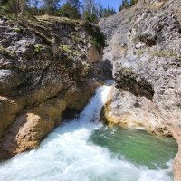
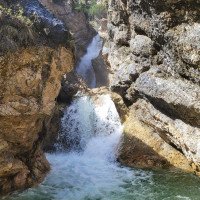
Deep canyon with impressive water force, followed by an approx. 2km long river walk.
Can be easily combined with the Weittalbach.
June - October
18.40km²
Summary:
machine translated
➜
Original language
Tief eingeschnittene Schlucht mit beeindruckender Wasserwucht, gefolgt von einer ca. 2km langen Bachwanderung.
Kann gut mit dem Weittalbach kombiniert werden.
Deep canyon with impressive water force, followed by an approx. 2km long river walk.
Can be easily combined with the Weittalbach.
Access:
machine translated
➜
Original language
Von Kramsach entlang der Brandenberger Ache bis zum Parkplatz (https://maps.app.goo.gl/WSEoA8iSn9xJMG5R7).
From Kramsach along the Brandenberger Ache to the parking lot (https://maps.app.goo.gl/WSEoA8iSn9xJMG5R7).
Approach (1 h 30):
machine translated
➜
Original language
(wenn die Tour in Kombination mit dem Weittalbach begangen wird: siehe Zustieg Weittalbach)
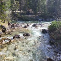
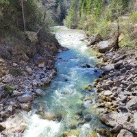
Vom Parkplatz aus dem linken Weg nach oben Richtung Weißachalm folgen (nicht dem nach rechts, welcher zur Brandenberger Ache hinunter führt) - vorbei an der Zöttbach- und Hochtalalm. Nach ca. 5km nach rechts in die Weißache hinabsteigen (auf Höhe Mündung Weittalbach). Nach ca. 150m Bachwanderung beginnt der enge Abschnitt der Schlucht.
(if the tour is done in combination with the Weittalbach: see Weittalbach access)
From the parking lot, follow the left-hand path up towards the Weißachalm (not the one to the right, which leads down to the Brandenberger Ache) - past the Zöttbach and Hochtalalm. After approx. 5km, descend to the right into the Weißache (at the mouth of the Weittalbach). After approx. 150m river walk, the narrow part of the canyon begins.
Tour (2 h):
Return (30 min):
machine translated
➜
Original language
An der Mündung der Weißache in die Brandenberger Ache entweder dem Wanderweg (rechts) oder der Schotterstraße (links) bis zur nächsten Brücke (Trauersteg) folgen. Von hier der Schotterstraße auf der rechten Seite wenige Minuten zurück zum Parkplatz folgen. Wenn der Wasserstand es erlaubt, kann man sich auch von der Mündung bis zur Brücke in der Brandenberger Ache treiben lassen.
When the Weißache flows into the Brandenberger Ache, follow either the hiking trail (right) or the gravel road (left) to the next bridge (Trauersteg). From here, follow the gravel road on the right-hand side for a few minutes back to the parking lot. If the water level passes, you can also float from the mouth to the bridge in the Brandenberger Ache.
Coordinates:
Parking Entry and Exit
47.548848°, 11.907571°
↓↑
DMS: 47° 32" 55.85', 11° 54" 27.26'
DM: 47° 32.931", 11° 54.454"
Google Maps
Austria Topo
DMS: 47° 32" 55.85', 11° 54" 27.26'
DM: 47° 32.931", 11° 54.454"
Google Maps
Austria Topo
Google Maps: https://maps.app.goo.gl/WSEoA8iSn9xJMG5R7 (gebührenpflichtig)
Canyon Start
47.548751°, 11.863118°
↓↑
DMS: 47° 32" 55.5', 11° 51" 47.22'
DM: 47° 32.925", 11° 51.787"
Google Maps
Austria Topo
DMS: 47° 32" 55.5', 11° 51" 47.22'
DM: 47° 32.925", 11° 51.787"
Google Maps
Austria Topo
Canyon End
47.554468°, 11.893662°
↓↑
DMS: 47° 33" 16.08', 11° 53" 37.18'
DM: 47° 33.268", 11° 53.62"
Google Maps
Austria Topo
DMS: 47° 33" 16.08', 11° 53" 37.18'
DM: 47° 33.268", 11° 53.62"
Google Maps
Austria Topo
New Report
06.04.2024
Clarissa Linder
⭐
★★★★★
📖
★★★
⚓
★★★
💧
Normal
Completed ✔
machine translated
➜
Original language
Auch mit dabei waren: Peter Lampacher
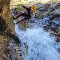
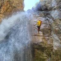
Alle Sprünge möglich. Beim höchsten Abseiler (17m) einiges an Geschiebe im Abseilverlauf, Seil evtl. schwer abziehbar. Alternativ kann man rechts ein paar Meter nach oben klettern und dort von einem Baum abseilen. Wasserwucht beim Abseilen.
All jumps possible. At the highest rappel (17m) there is some rubble in the course of the rappel, rope may be difficult to pull off. Alternatively, you can climb a few meters up on the right and rappel from a tree. Water force during rappel.
Auch mit dabei waren: Peter Lampacher
Hydrology:
